
Sample report
A real farm. A flood the FEMA map missed.
Section 13, T67N R43W, Fremont County, Iowa: 651 acres, run with the same report every customer gets. Below is the summary; the full 19-page PDF is one click away.
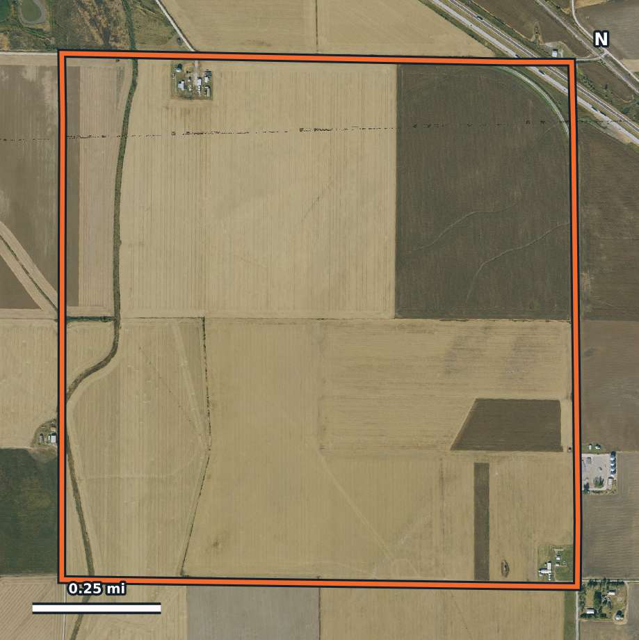
Farm X-Ray report
Fremont County, Iowa · 651 ac
- Score
- 45 of 100 · significant issues
- Why
- Capped at 45 by the 2019 flood. The other factors alone average 80.
- Checked
- Over 25 public records in four parts: risk, restriction, opportunity and region
- Format
- 19-page PDF, every item with a map or table, what it means for a buyer, and the source and date
The part no one else has
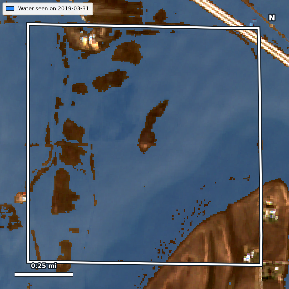
Flood history from satellite, every clear day since 2017
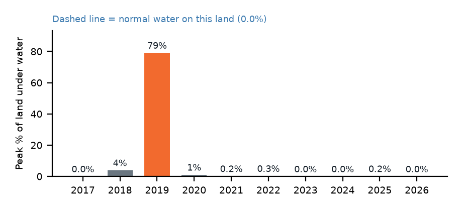
292 clear images. Normal water on this land: 0%. In 2019 it reached 79%.
Under water by satellite, outside the FEMA flood zone
79% · 516 ac · Mar 31, 2019Sentinel-2 saw 79% of the land under water on March 31, 2019, and the water stayed above normal for about 111 days. The FEMA map puts none of it in a flood zone.
Next stepAsk the seller about 2019: crop loss, prevented planting claims, levee repairs, sand deposits. Pull the crop insurance and FSA records.
Railroad and Interstate 29 cross the land
recorded rights-of-wayA BNSF line and I-29 cut across the northeast corner. That ground is not yours to farm and splits the field.
Next stepCheck how many acres the survey excludes before you agree on a price per acre.
Mapped wetlands
4 wetlands · 4.5 acSmall mapped wetlands sit in the low ground. Under Swampbuster, draining or filling them to farm can cost the operator USDA benefits.
Next stepAsk for the NRCS certified wetland determination and the FSA AD-1026.
Water use permits on the land
2 wells · 1 intakeIowa DNR has water use permits recorded on this land.
Next stepAsk whether the permits are active and transfer with the land.
FEMA flood zone
none mappedNo FEMA flood zone polygon touches the 651 acres. That is exactly why the satellite history matters here.
Contamination, mines, feedlots
none within 1 miNo Superfund, hazardous waste, brownfield, mine or oil well within a mile. The nearest permitted hog barns are 1.6 miles away.
Soils and earnings
81% prime farmland · county rent $215/acMostly class 1 and 2 soils on flat ground; corn and soybeans since 2008, with much of it idle in 2015, 2019 and 2020.
This report is a screening based on public maps. It does not replace a wetland delineation, a Phase I environmental site assessment, a survey or a title search.